 Good Evening! Well it was another gorgeous day today across the Tri-Counties with temperatures in the 20's, Shelburne being the hot spot at 26 degrees. 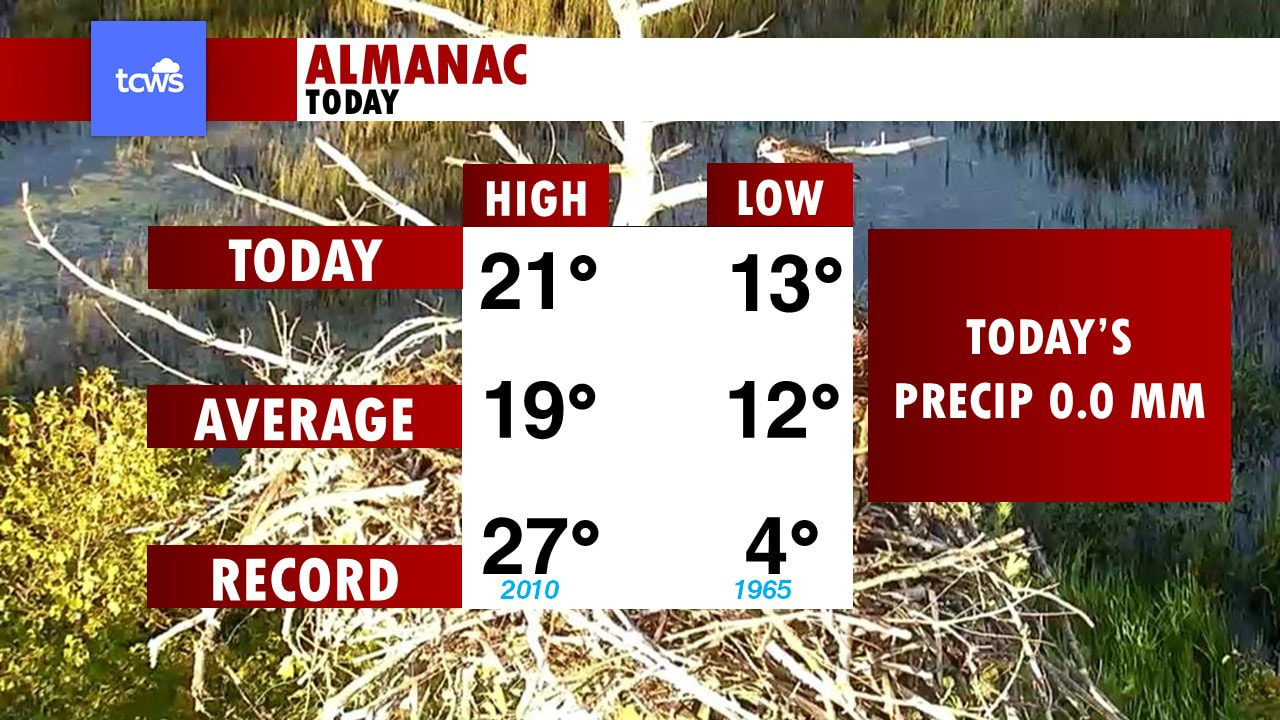 Almanac today, 22 it hit in Yarmouth, the Average is 19 for this time of year. back in 1973 it was a hot 28*C, our low this morning was 14, average is 12, and back in '75 it was a chilly start to the morning at only 5 degrees. 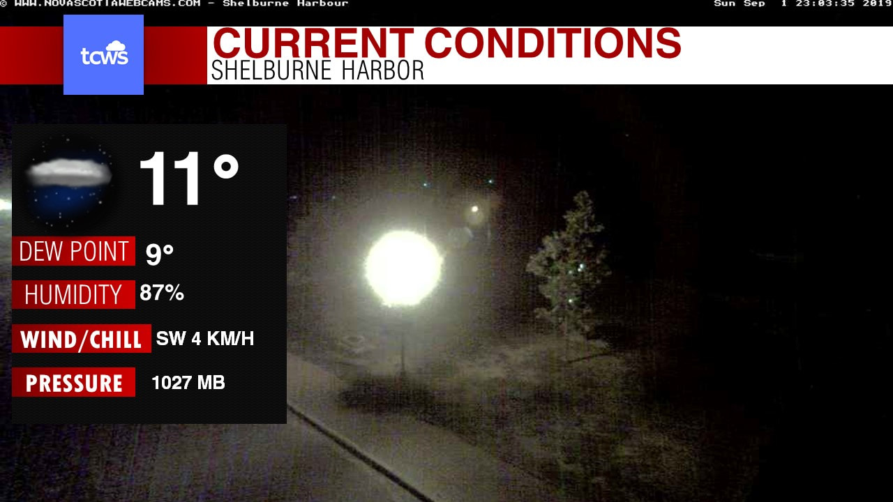 Currently in Yarmouth @ 11pm, it is cooling down! now down to 15 degrees, a dew point of 13, winds from the NW at 13km/h and a high pressure of 1022mb. 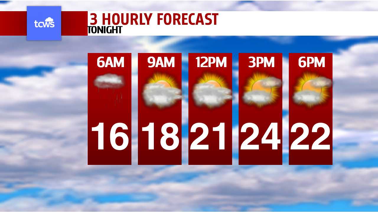 Taking a look at tonight's hourly forecast, temperatures continue to cool as we get through the night with temperatures down into the lower-10's, under clear skies. Sunny skies to wake up tomorrow morning at 6am and a cool 10 degrees, we'll warm up nicely to 14 by 9am and into the 20's by noon tomorrow. An area of High pressure will settle over the Atlantic provinces through Monday to bring us continued sunshine and warmth for remainder of the long weekend. Clouds will creep in Monday afternoon and evening ahead of a weak cold front that will bring rain into the area late Monday night into Tuesday afternoon, some areas of the Tri-Counties will get a beneficial rainfall too! Rain will arrive in Digby and Yarmouth county near Midnight tomorrow night and will move very slowly! in fact, by 6am Tuesday morning, it is still raining moderately over Digby and Yarmouth while Shelburne sees drizzle. By noon Monday, The heavier rain moves into Shelburne and continues to rain quite heavily for Yarmouth while Digby sees more showers and light rain. By 6pm Monday night, Most of the rain is offshore, however some drizzle and light showers left over in Yarmouth and Shelburne, but Digby is done with the front, and everyone is done with the rain by 11pm. So how much rain can we expect from Monday Night through Tuesday night? a wide swath of 5-15mm, however there will be some locations that will see amounts of 15 to 25mm. Sporadic showers look to linger into Wednesday and Thursday of next week for the first day of school, with risk of T-storms. Temperatures cool down to near seasonal with highs dropping below 20-degrees. 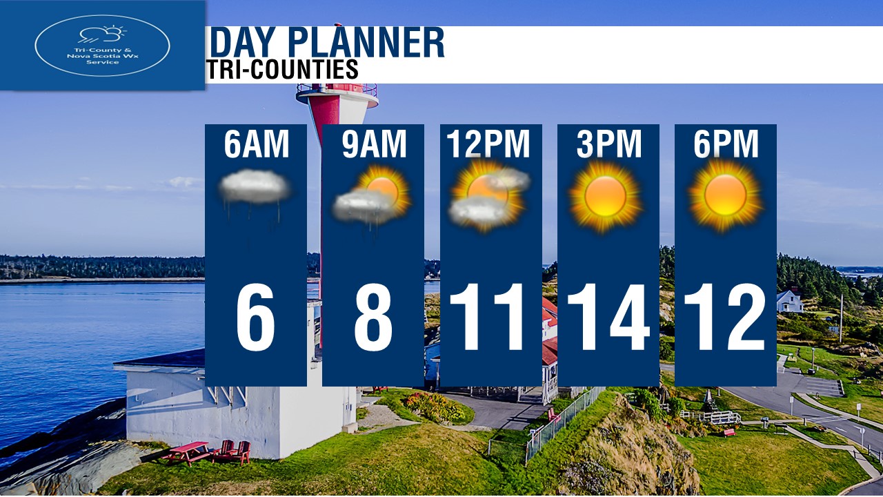 Dorian a very dangerous Hurricane heading for the Bahamas!As of 11pm Atlantic time, Dorian remains a Category 4 Hurricane with winds of 150 M.P.H or 241 km/h with Gusts of 296 km/h! Dorian is moving West towards the Bahamas and will make landfall near Marsh Harbor tomorrow afternoon as a very strong Category 4 hurricane with winds of 240 km/h and higher gusts to near 300 km/h.
A big ridge of High pressure is what helping steer Dorian to the West and will steer him to the NE Monday, helping it miss Florida and near the Carolinas by Thursday. Hurricane warnings are up for the entire Bahamas and a Tropical Storm watch is issued for parts of Eastern Florida. It is still way to soon to say and tell what Dorian may do here closer to home, but many models are suggesting it will stay just enough offshore as a strong hurricane, We will be watching this very closely! ~ James |
AuthorChief Forecaster for TCWS M-F @ 5p, 6p, 7pm,10p & 11pm. Also a Chief Meteorologist for CHMR 93.5 FM in St. John's. Archives
August 2019
Categories |
 RSS Feed
