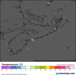
 Another cold morning out there it was this morning! Temperatures at 6AM this morning bottomed out at -8 degrees over in Collegeville, -6's in Upper Stewiacke and Malay Falls, -5 in Parrsboro and Debert in Western Nova Scotia, almost everyone in the province was below freezing. Only warmest areas was folks near the water, as the winds off the water pushed the warm water temperatures along the coast, temperatures along the coast just barely hanging on to above freezing. 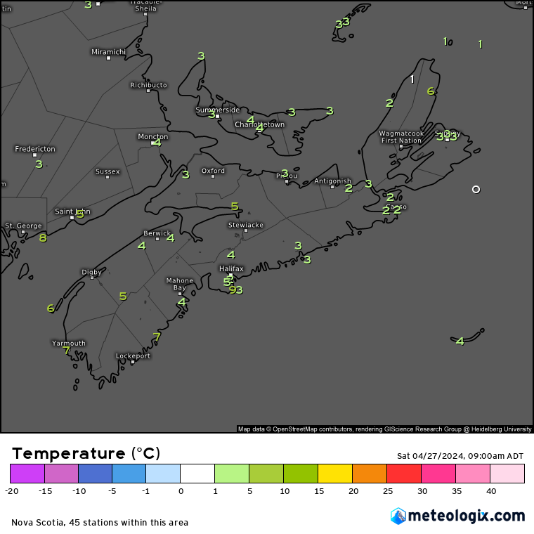 Fast forward to 3 hours later, as of 9AM, temperatures have rebounded big time, we have the strong April sunshine to thank for that! Remember, that April sunshine is about the same as in August! so the temperatures climb very quickly in a few hours in the morning, the sun is also strong, so High UV readings, and risk of sunburn increases. Temperatures out there right now as of 5AM, we're at 7 in Yarmouth, 7 in Western Head, 6 on Brier Island, 3-5 in Halifax County and Metro. 2-4 degrees over much of the mainland, 3 in Cape Breton County. 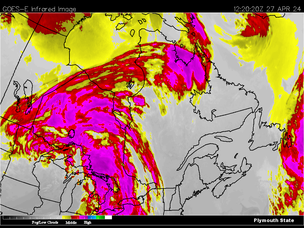 We have a lot of sunny skies out there once again, and it's thanks to a stationary high pressure. We're sandwiched between 2 storm systems, one large system over the Great Lakes and the other off the coast of Newfoundland. and in between is a High pressure keeping the Maritimes and East coast dry. We have this Large High pressure over us, with a large high pressure gradient, pressure over 1035mb, But there is a Stormy Low pressure over in the Mid-West US States, as well as a large cold front stretching from Hudson Bay to the Northern US states and Interior of British Columbia. 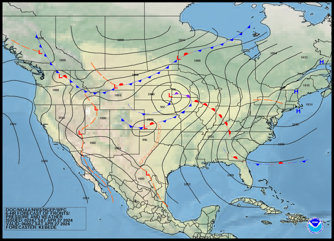 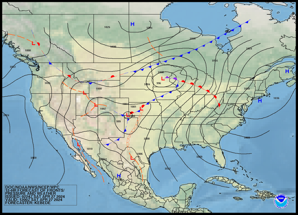 By later Today, High pressure holds control over us, Thundery showers and Gusty winds takes hold over the Great Lakes and much of the 4 corner states. Large High pressure over Western Canada bringing sunshine, but a cold front passing through Hudson Bay will bring cooler temperatures. 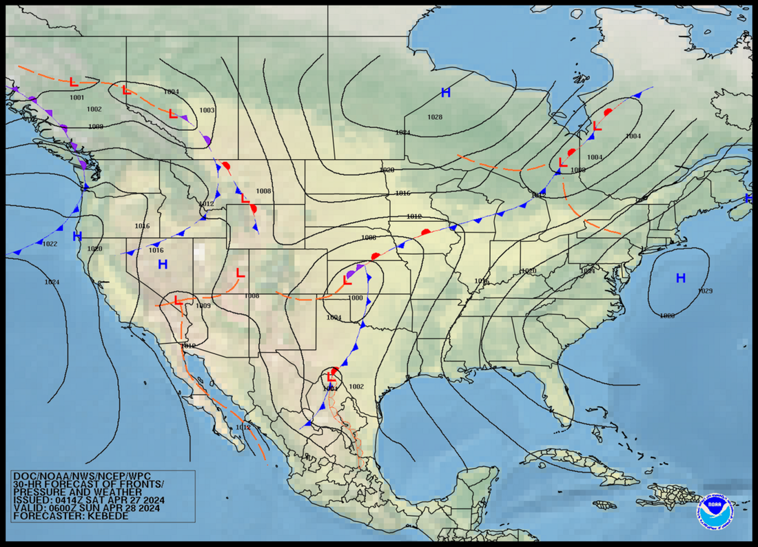 By Tonight, Looking at High pressure weakening a little but still holding strong over the Atlantic, this will bring us clear skies, another cold night as well. The Great Lakes storm moves over Quebec/Ontario border south of Hudson Bay, meanwhile High pressure brings cold clear skies over the prairies, but a Low pressure develops over Western Canada to bring Unsettled weather and cooler temperatures.  Looking at Tomorrow Morning, Weakening high pressure will bring continued sunshine, but clouds will be on the increase into the South, the weakening High pressure will allow the Cold front over Quebec stretching to the Mid Western States and down to Texas to bring clouds and showers as well as cooler temperatures Sunday Night into Monday, High pressure tomorrow morning over Ontario and the Prairies will bring more sunshine and comfortable temperatures, Continues to be unsettled in Western Canada with cool temperatures. 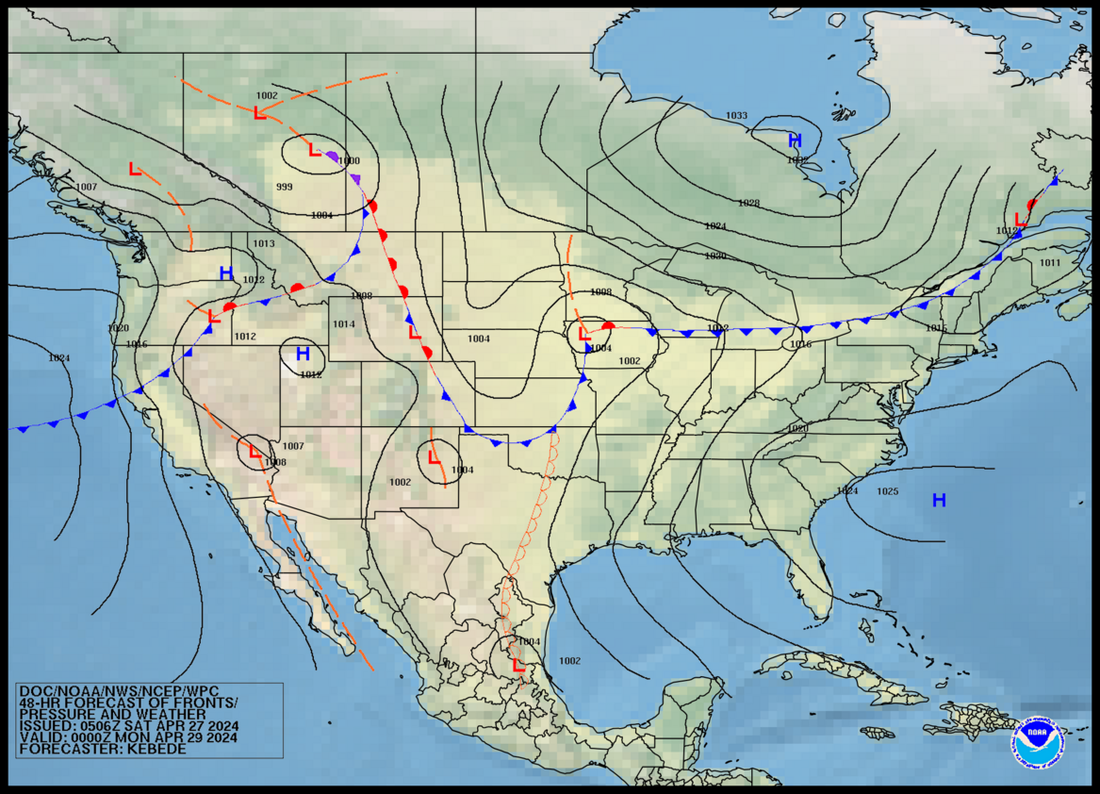 Looking at Sunday Night, the high pressure that brought us the gorgeous weather now much weaker and pushed far south near Florida, the cold front now located Southern Quebec bordering New Brunswick will bring showers to the Tri-Counties and The Valley, meanwhile cooler temperatures will follow on Monday. High pressure over Hudson Bay moves South, bringing breezy but cool dry weather over Quebec & Ontario, unsettled weather continues in Western Canada.  Monday Morning, Looking at a warm front over the Tri-Counties, this will bring mild and humid temperatures, but also some showers and fog. A cold front over the Bay of Fundy will bring colder temperatures Monday evening. Low pressure over the Great Lakes will bring more thundery weather and very warm and humid Temperatures, Feeling into the 30's for some parts of Southern Ontario. Low pressure that was in Western Canada moves into Alberta and Saskatchewan to bring showers and thunderstorms. High pressure moves in over BC to bring drier weather and North westerly cool winds which means cooler temperatures. Cold front over Northern BC will bring a chance of showers and chilly temperatures. 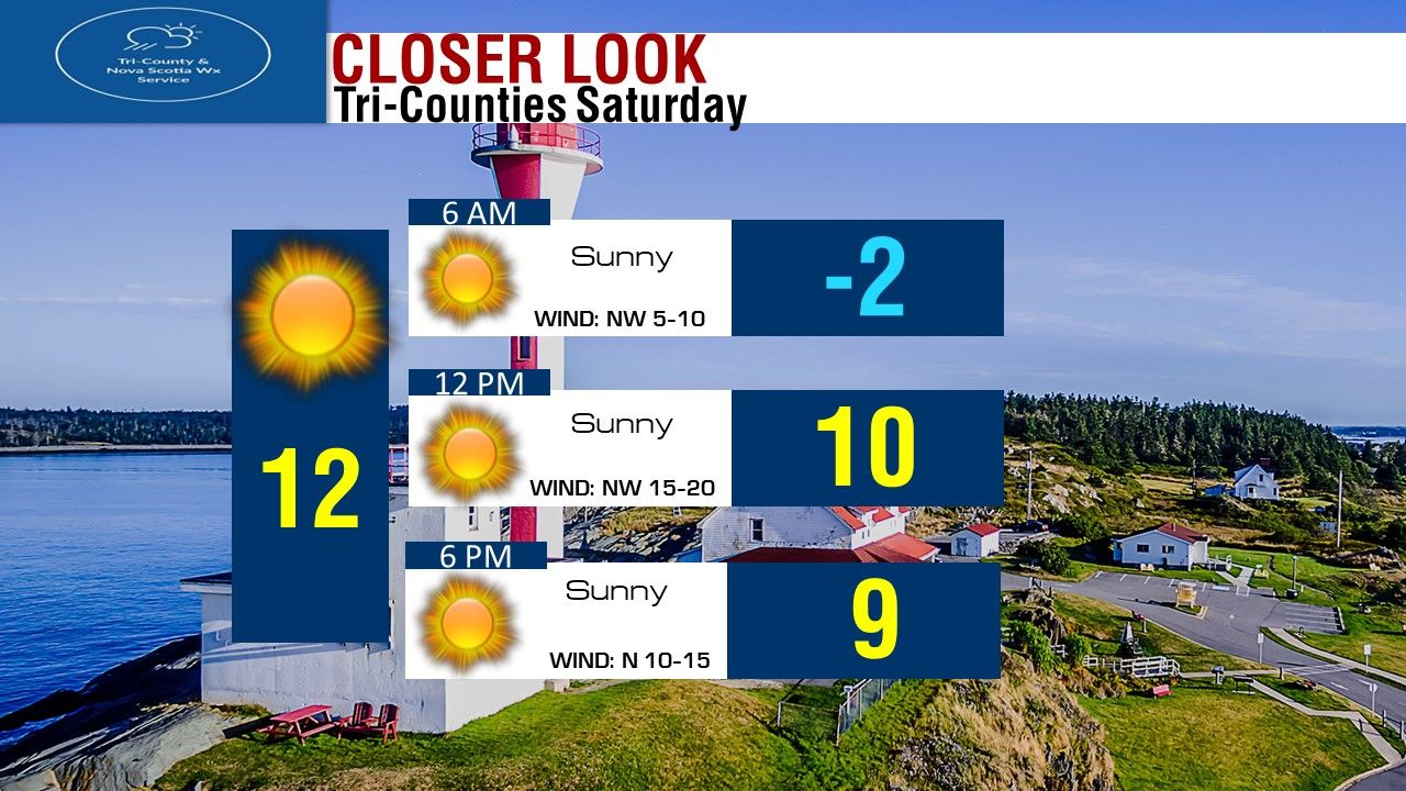 Looking at sunshine today all day long in the Tri-Counties and all of the province in fact! Temperatures this morning again starting off near or below Freezing. Will warm up to near 10 by Noon, and around 9 degrees by Supper hour. North Westerly winds 5-10 this morning will pick up to 15-20 this afternoon, winds turn Northerly this evening at 10-15 km/h. Highs in the Tri-Counties today will be around 12 degrees. 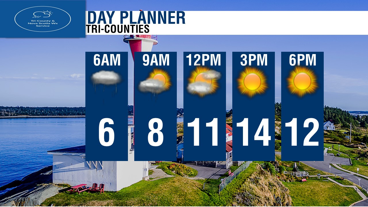 Looking at the Day Planner, Looking at Sunshine from start to finish, temperatures cold this morning, warming up nicely by this afternoon! 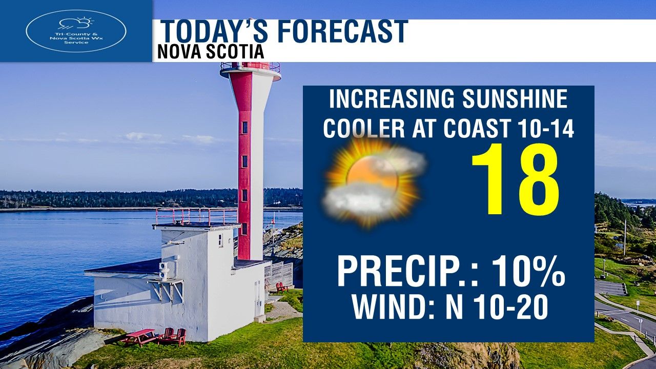 For Today, Wall to wall sunshine! highs of 14 in the warmest spots, coolest temperatures near the coast and in Northern Nova Scotia. 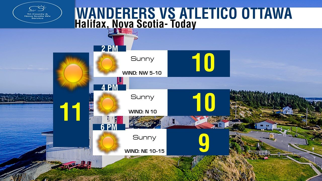 If you're in Halifax, and You're going to the Wanderers Soccer game against Atletico Ottawa, Before the game, we'll see temperatures near 10 degrees, we'll see sunshine for the first kick off at 3pm, and midway through the game we'll see sunshine and temperatures near 10-11 degrees. By time the game ends, we'll see sunshine and still near 10 degrees. Great Soccer weather! 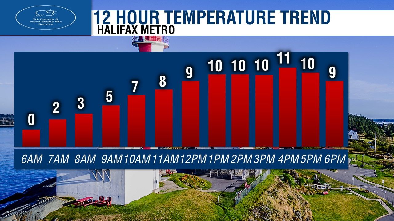 Temperatures in the Halifax Metro today, starting off Freezing, we'll see it warm up to 5 degrees by 9AM, then 9 degrees by Noon, and holding near 10 or 11 this afternoon. 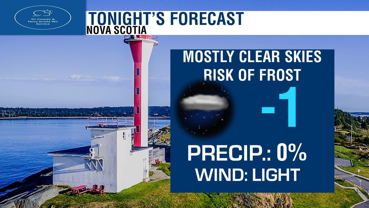 Tonight, we'll see clear skies and cold temperatures again. near -5 in the coldest spots, milder near the water. Lighter Northerly winds. 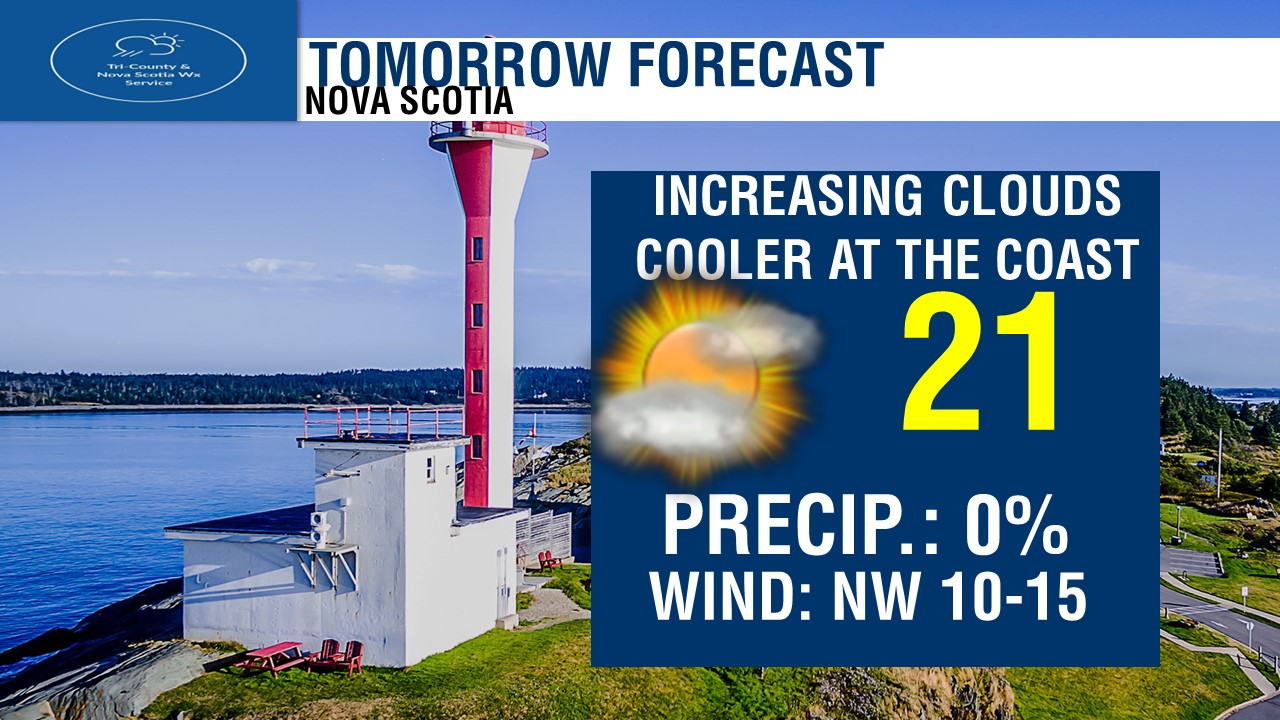 Tomorrow, We'll see increasing clouds in the South from the Valley to Yarmouth, Sunshine north. Much warmer! temperatures of 14 to 18 in the warmest spots inland. coolest near the water and over Northern Nova Scotia. Westerly and North-Westerly winds light. 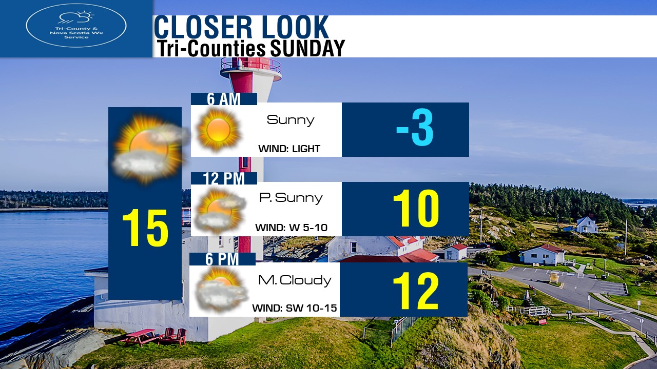 If you have plans in the Tri-Counties tomorrow, here is how things look to plan out weather wise! Looking at full sunshine to start, another cold morning near or below freezing. We'll quickly climb to near 10 by noon, with increasing clouds and Westerly light winds. We'll see lot's of clouds by Supper time, temperatures near 12 degrees. Highs in the Tri-Counties will reach around 15 tomorrow! Looking at the Regional 3 Day Forecast.
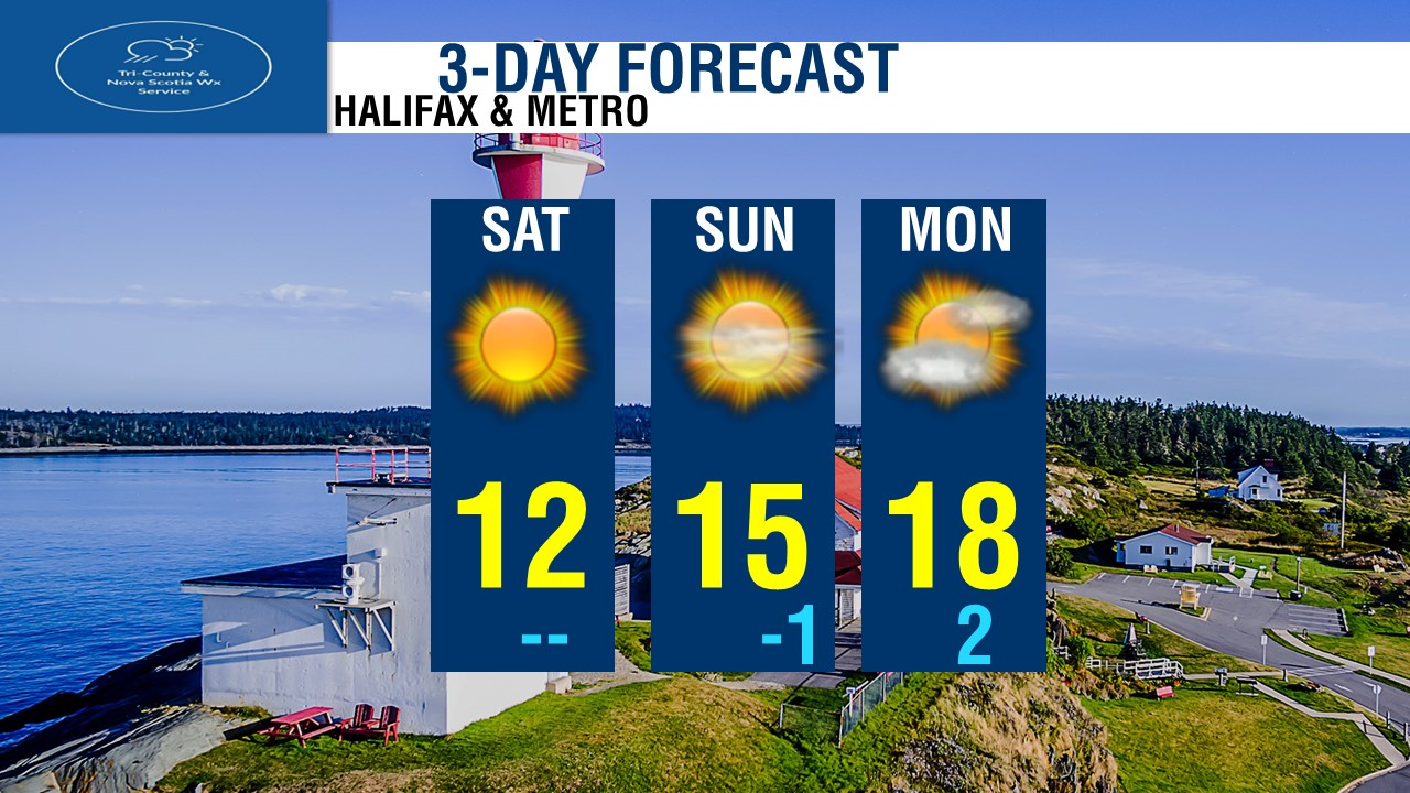
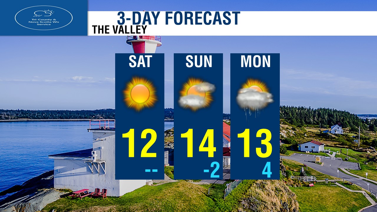
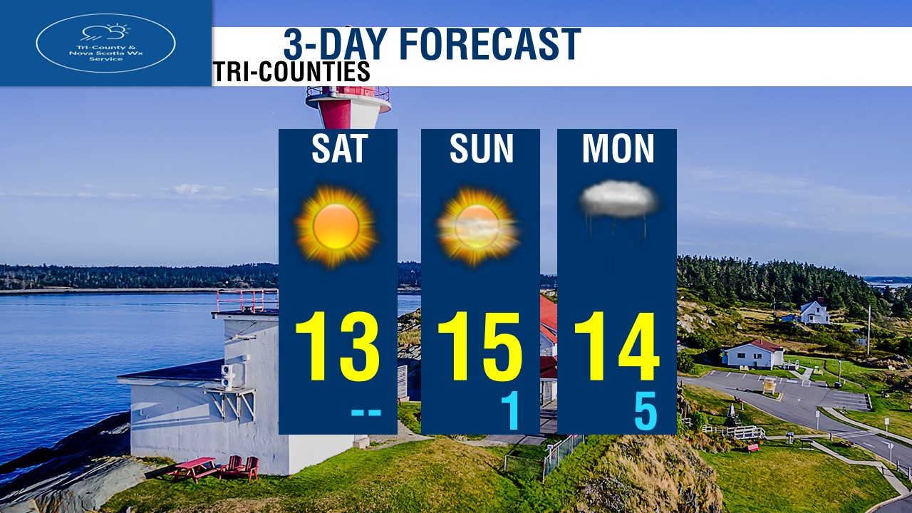
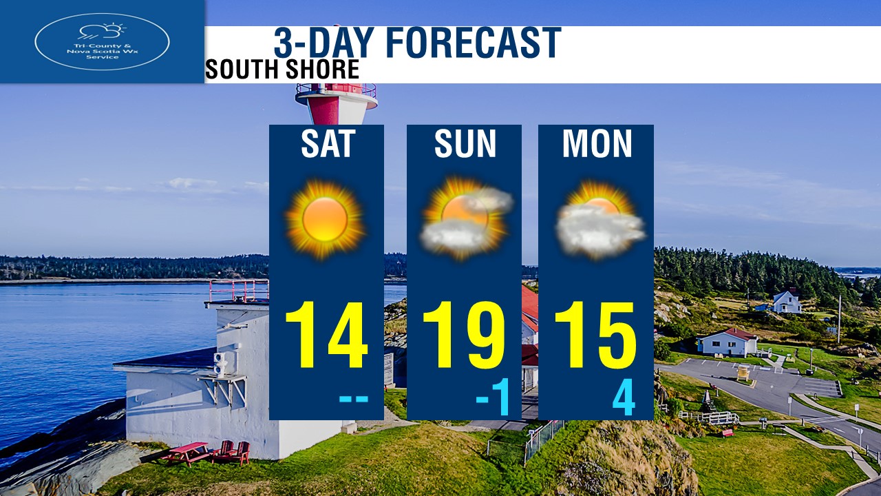
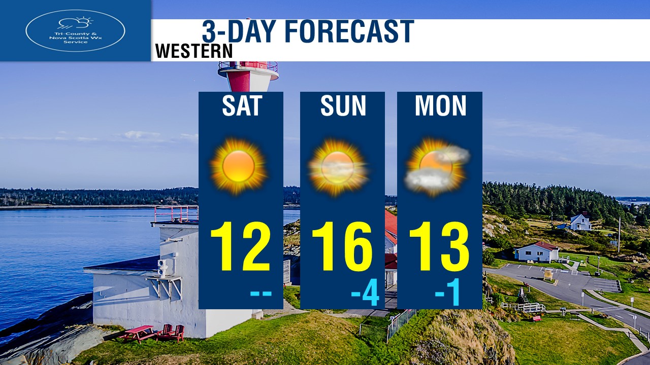
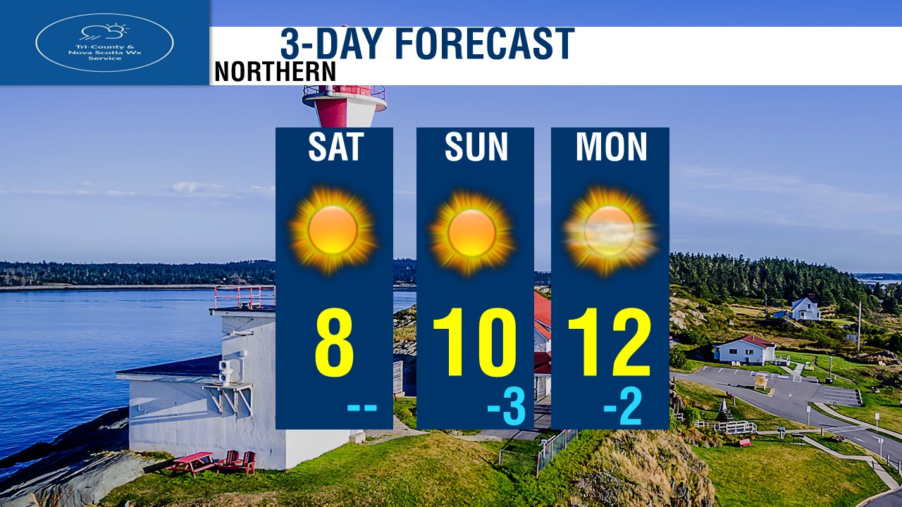
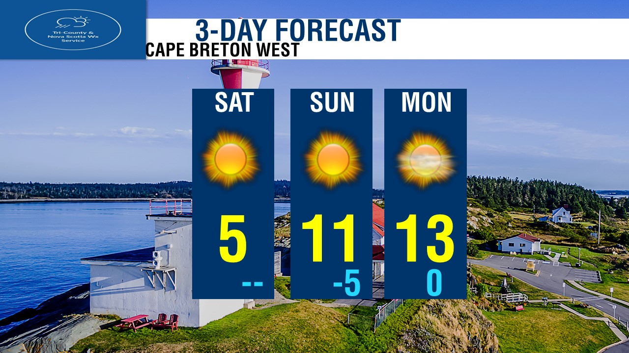
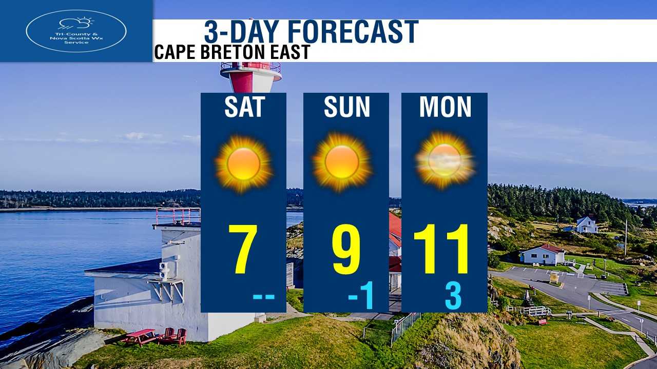
Starting with Halifax & Metro, Looking at sunshine Today and Tomorrow, increasing clouds on Monday. Temperatures of 12 today to 18 on Monday. For The Valley, looking at Sunshine today, Clouds on Sunday, and a chance of showers on Monday. Temperatures of 12 to 14 degrees. For Tri-Counties, Sunshine today and tomorrow, showers on Monday. Highs of 13 to 15 degrees. For South Shore, Sunshine today, Tomorrow and Monday with increasing clouds. Temperatures warming up nicely! 14 today, Balmy 19 Tomorrow! and slightly cooler day on Monday at 15 degrees. For Western, Sunshine today, increasing clouds Sunday and Monday. Highs of 12 today, up to 16 Tomorrow and 13 on Monday. For Northern, Lot's of sunshine all 3 days! Saturday, Sunday and Monday. Cool day today highs only in the upper single digits. we'll be near 10 Tomorrow and 12 on Monday. For Cape Breton West, Sunshine all 3 days! A cold day today with highs only near 5, we'll warm up a lot by tomorrow, highs near 11! and 13 on Monday. For Cape Breton East, Sunshine all 3 days, a cool wind will keep temperatures cool today and tomorrow in the single digits with highs of 7 to 9 degrees, up to 11 by Monday.
0 Comments
Leave a Reply. |
AuthorThis is where our forecasters will post the forecast updates at the normal update times. Archives
April 2024
Categories |
 RSS Feed
