Winter Storm Donavan brings Wintry mess Tonight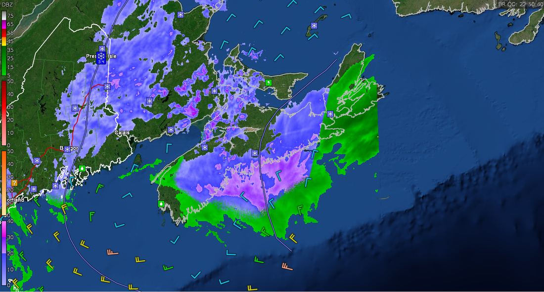 Wintry weather continues over most of the province this evening, and will only continue into tonight and the early hours of Sunday Morning New Year's Eve. The system is the remnants of Winter Storm Donavan, and is located off the coast of Yarmouth. The systems will depart by tomorrow morning for most, except still be over Northern NS by tomorrow near noon. 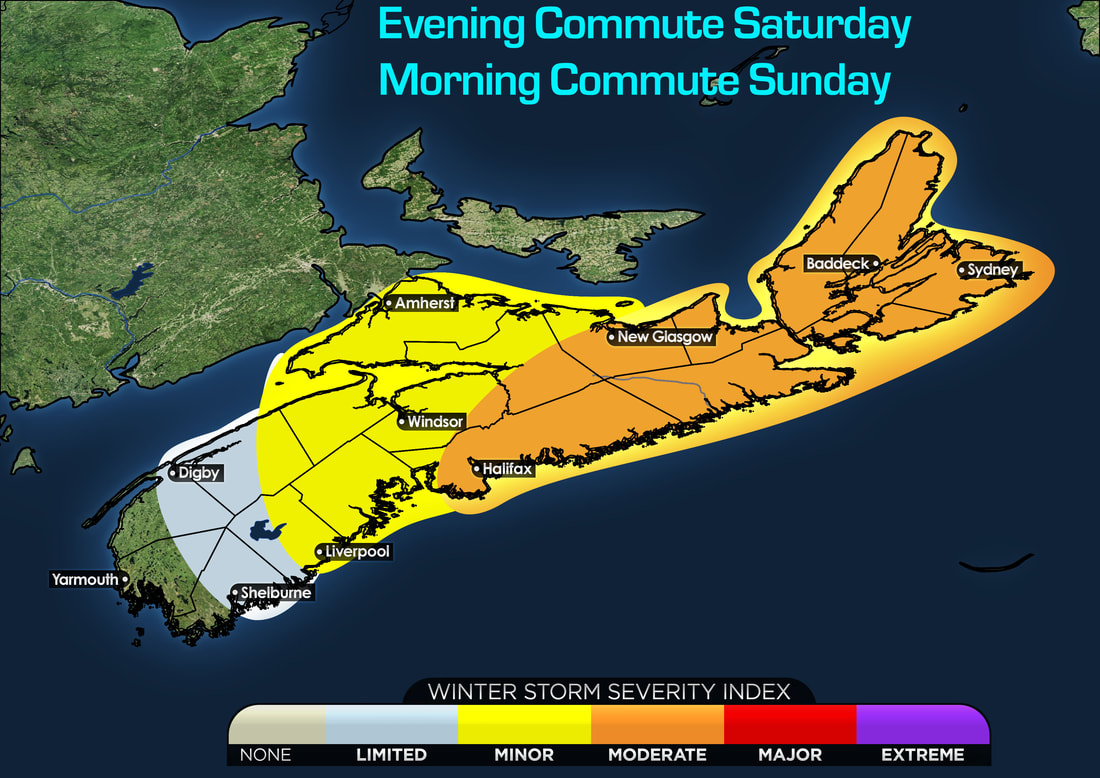 For the Evening Commute this evening and the commute tomorrow morning, looking at a WSI generally in the moderate category for Halifax, Northern NS and Cape Breton. This where we will see the highest snowfall amounts, some mixing of ice pellets and Freezing Rain and gusty winds, all this will give for hazardous travel and will likely lead to some travel disruptions. In Western NS, The South Shore, Eastern parts of the Valley the impacts will be minor, where only a small snowfall and some ice will lead to some minor travel disruptions. In Digby and Shelburne, as well as Western parts of the valley, looking at Very limited activity, very little snowfall, and mostly rain will cause very little to no impacts. but some slick roads is likely, but no travel disruptions. 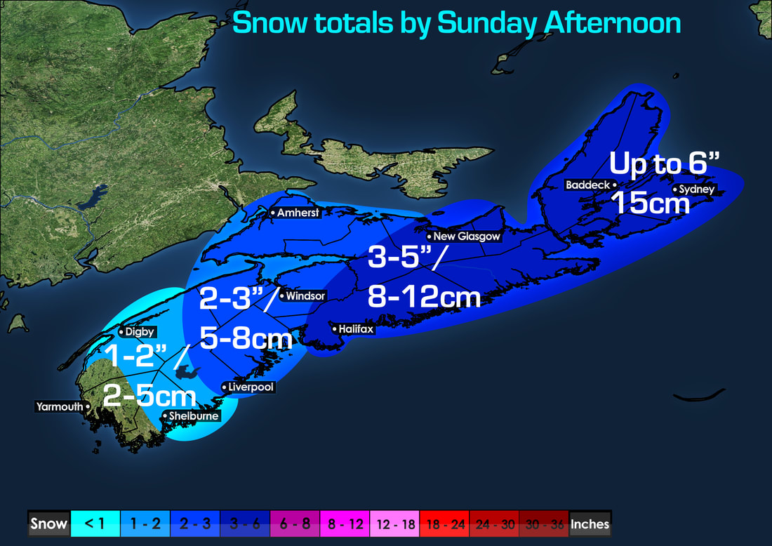 Snowfall amounts are generally light for many for those living south of Halifax, where amounts of only a few inches is expected, around 1-3" or 2 to 8cm. However a more higher snowfall expected over Halifax, New Glasgow, Baddeck to Sydney. where between 8 and 16cm can fall, highest near Cape Breton. New Year's Forecast Is Dry And Turning Colder Looking at the FutureCAST taking us into New Year's and through mid week. We'll see a high pressure keeping us dry Sunday, Monday, Tuesday and even Wednesday. although lot's of clouds, it will be dry! but cold! 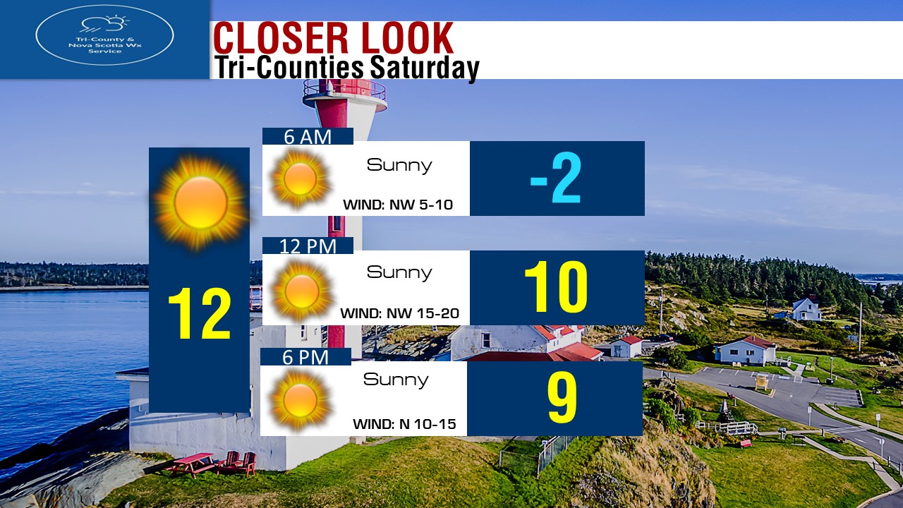 Forecast for tomorrow in Halifax will be cold and snowy to start, but we'll gradually get nicer through the day, but still chilly! Still Watching For Possible Major Nor'Easter Late In The Week.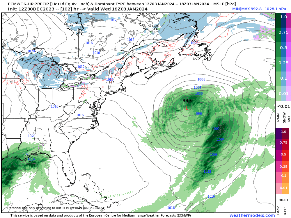 The Next Nor'easter will arrive late in the week, either Thursday or Friday. We have a cold core storm system over the Great Lakes, and our Warm Tropical Low over the Gulf of Mexico. That cold system will swing North East, meanwhile the Warm system heads South & East towards the cold system, this timing is on Wednesday Afternoon. 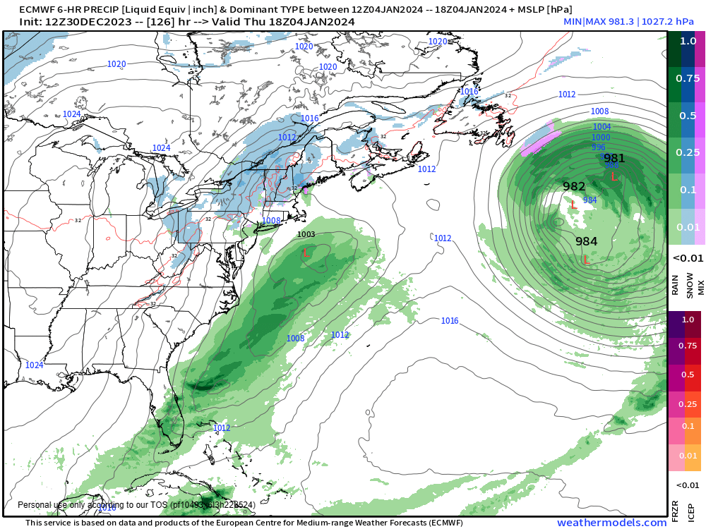 By Thursday Afternoon, the cold system is now over the New Hampshire/Quebec Border, and the warm system is developing more offshore just off Cape Cod. 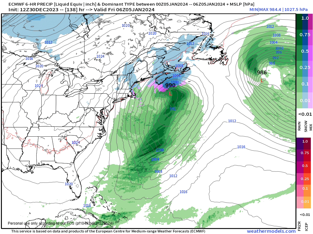 By Thursday Overnight into Friday Morning, around 2 to 3am. we'll see the both systems merge to form a stronger system, winds will increase, but snow at times heavy will cover the province Thursday night and continue into Friday. 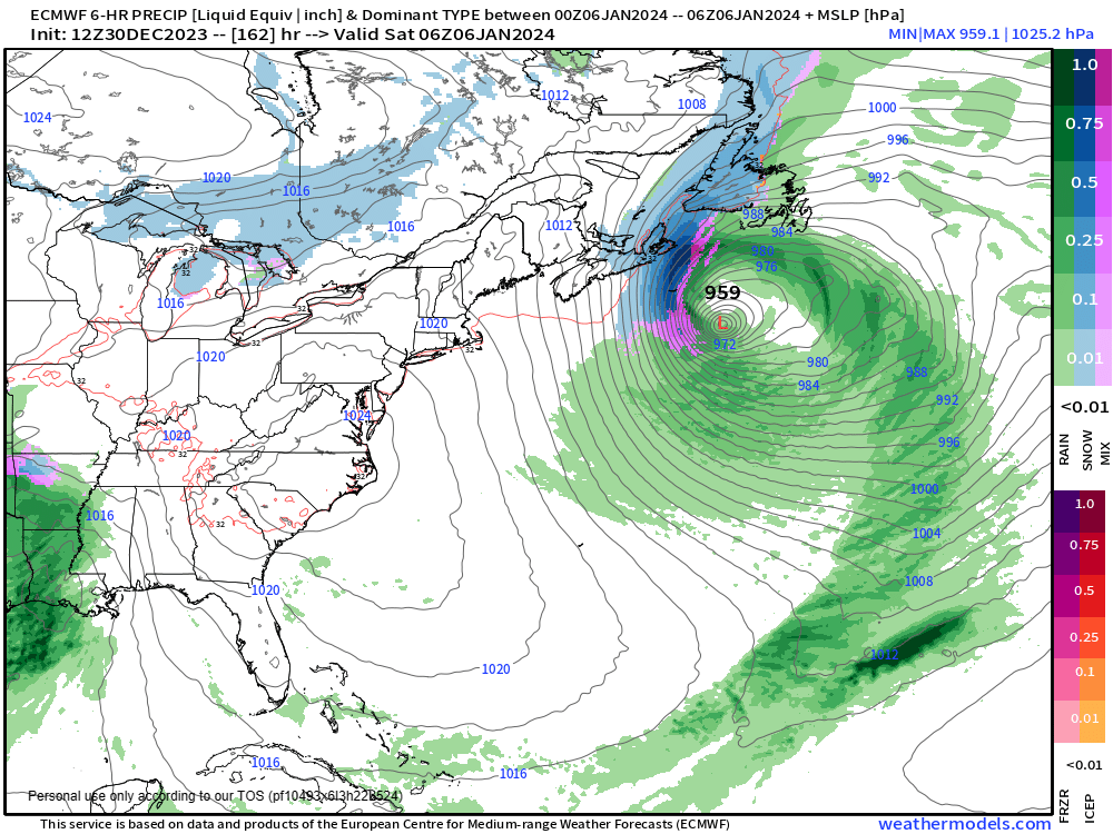 By Friday Overnight into Saturday, the nor'easter is very strong with a pressure at 959mb just off the South East of Sable Island. Although snow will be done with over Halifax and folks South of the city. there will still be very gusty winds causing blowing and drifting snow. For Cape Breton, we will see Big blizzard conditions continue with very strong winds and very heavy snow. 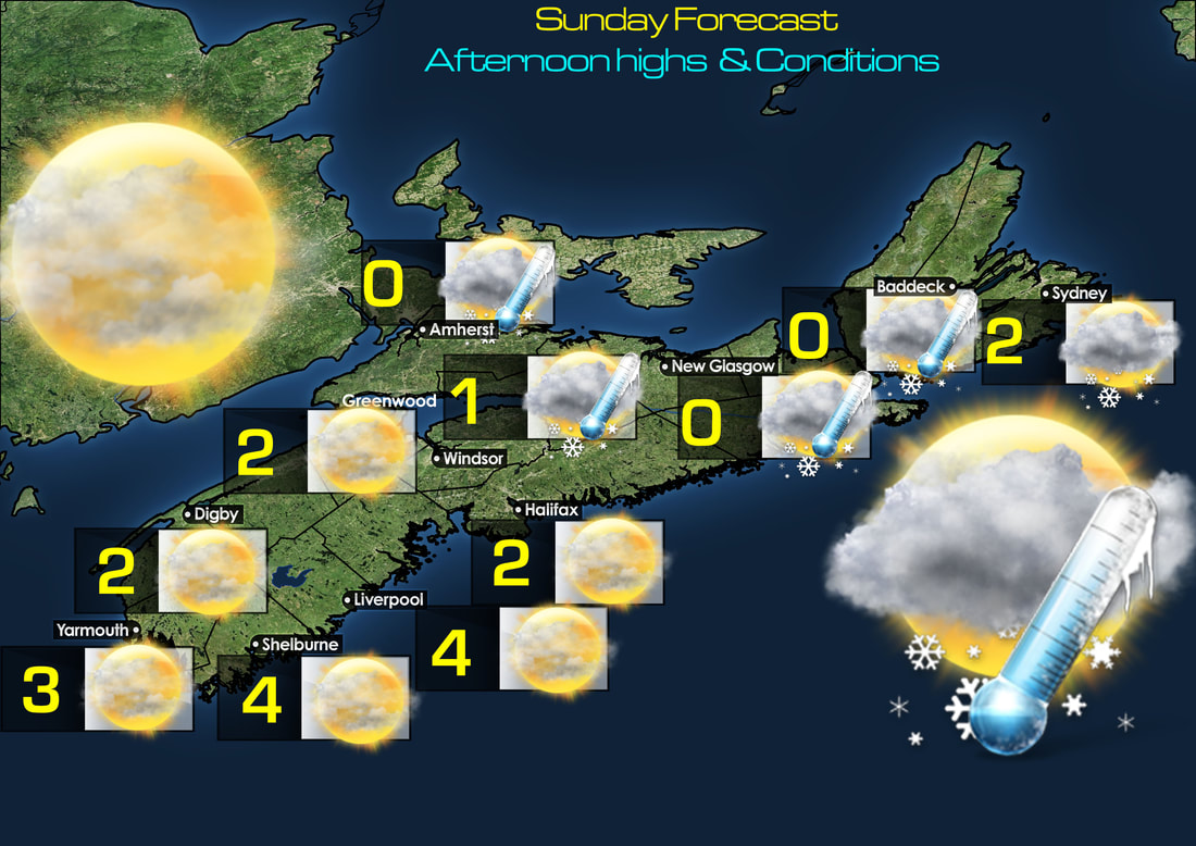 Tomorrow's Forecast for the last day of 2023, we'll see Partly cloudy skies, except flurries North. Highs between 0 and 4 degrees. 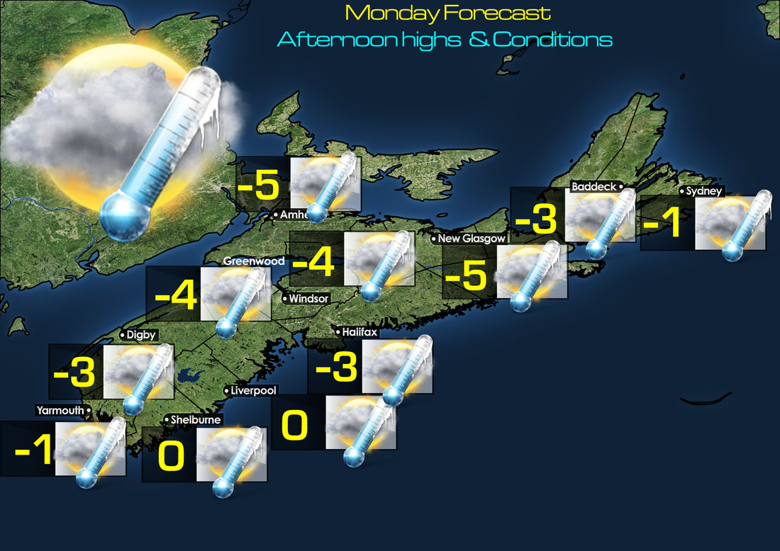 New Year's Day Full day of 2024, we'll see Mostly Cloudy skies and cold air! highs of 0 to -5. 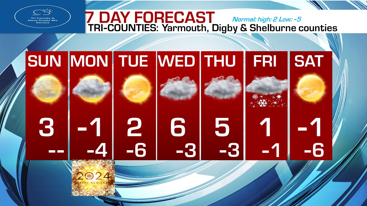 Looking at 7 day forecast, we'll see dry weather Sunday, Monday, Tuesday, Wednesday, and Thursday. We'll see highs not bad Tomorrow near 3 or 4 degrees. we'll be a bit chilly to cold on Monday, at -1. Lot's of sunshine on Tuesday and 2 above zero, We'll see milder temperatures on Wednesday and Thursday with highs near 5 and 6.
By Friday, we're watching that major Nor'easter. Sunshine for the first weekend of 2024! highs to be near normal! near -1.
0 Comments
Leave a Reply. |
AuthorThis is where our forecasters will post the forecast updates at the normal update times. Archives
April 2024
Categories |
 RSS Feed
